Client: Teck Coal/Golder Associates
Site: Fording River Operations
Project Duration: 2014
Project Summary:
- Structural geology of the Turnbull open pits and adjacent region
- Structural evaluation of oriented geotechnical boreholes
- Assessment of lithological drill holes
- Construction and interpretation of structural sections and maps
- Correlation of boreholes with structural cross sections
- 3D sub-surface geological modelling of fault systems using Leapfrog software
- Assist with slope stability assessment and failure mechanisms within the open pit
- Correlation of structures with I-sight scanning software and integration of results with the structural model
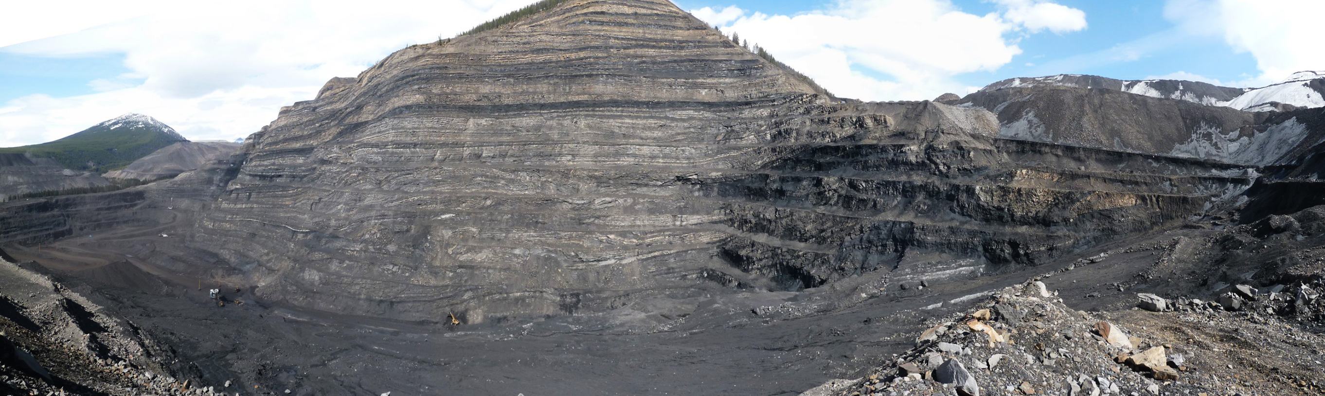
The Fording River Coal deposit is located in the Rocky Mountain Fold-Thrust Belt, and is one of a number of world class coal deposits in this region of British Colombia.. Teck’s Fording River operation is located 29 kilometres northeast of the community of Elkford, in southeastern British Columbia. The mine produces steelmaking coal. The current annual production capacities of the mine and preparation plant are approximately 9.0 million and 9.5 million tonnes of clean coal, respectively. Proven and probable reserves at Fording River are projected to support mining at current planned production rates for a further 70 years.
The Turnbull Pit geology is overall fairly straight forward on the large scale but locally complex on the small scale with stacked thrusts intense folding and triangle zones. The resulting structures provide multiple surfaces for potential failure in and around the pit and it is therefore of paramount importance to understand these structures and their orientations in order to provide a template for stability analysis and mine planning.
Info Link
http://www.teck.com/operations/canada/operations/fording-river/
http://www.ggslimited.co.uk/wp-content/uploads/2016/01/lewis_thrust.pdf